- Author Matthew Elmers elmers@military-review.com.
- Public 2023-12-16 21:49.
- Last modified 2025-01-24 09:17.
On February 8 (January 27), 1812, a new structure appears as part of the Russian Imperial Army. This is the prototype of the Military Topographic Directorate of the General Staff of the RF Armed Forces. Then the structure received the legal status of the Regulation for military topographic affairs, being created on the basis of the highest decree of Emperor Alexander I.
The formation of the topographic service was associated with new military realities. The command came to the conclusion that the loss of personnel, weapons and cavalry (cavalry) can be associated not only with the offensive potential of the enemy or the nature of its own defensive (offensive) actions on the battlefield, but also with the terrain. Using the landscape component to organize ambushes, to conceal the movements of individual units, and even formations, for a surprise strike, you can not only get a local advantage over the enemy, but also win in a much more significant plan - strategic. Even the very choice of the future battlefield was of growing importance. It is clear that this fact was familiar to the military leaders even before 1812, but earlier the study of the area was not systematic and did not directly fall under the issues of documenting the tactics and strategy of warfare.
The creation of a topographic service in the Russian army radically changed the situation. One of the components of the formation of the new structure is the formation of a portfolio of topographic maps, which had a dual purpose. After all, they could be used not only in military affairs, but also in civil engineering - including for the construction of roads, bridges, and other infrastructure facilities.
It was military topographic maps that became the basis for the development of the railway industry in the Russian Empire. Also, with their help, issues of urban planning, organization of transport logistics were considered. This was a truly valuable material, which played an important role in terms of the economic development of the state.

What are the tasks of topographic and geodetic support today? By and large, despite the past two and a half centuries, these tasks have not changed. We are still talking about the accumulation of stocks of topographic maps, catalogs of geodetic and gravimetric points, and their updating. At the same time, of course, the means and methods have changed. Digitalization is sweeping the world, and the topographic service is, as they say, in a trend. Servicemen of topographic units create digital maps that can be promptly sent to electronic devices to obtain deep and high-quality information in one way or another.
Work on photographic documentation of the area is also important. The photographs, which are also numbered, are an important link in combat planning, including the situation regarding the deployment of units in the area of the operation.
Such maps and images play an important role in search and rescue operations and in taking anti-terrorist measures.
Digitized maps today make it possible to improve the operation of systems for automatic control of troops and weapons. This is a special kind of activity for military personnel in modern conditions, especially when it comes to network-centric interaction between individual units of the contingent (several contingents).
It is also important to note the preparation of the basis for the provision of missile launches, the construction of airfields, launch sites, the creation of training grounds for combat operations and testing of the latest weapons.
At the moment, active creation of geospatial materials (the so-called "360 format") is underway, when information is mapped and photo-documented not in a plane version, but in a three-dimensional graphics mode. For planning combat operations, this is a truly significant tool that allows you to control the operational space in the unit's area of responsibility.
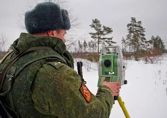
Military topographers in their service use various technical systems, including the Geonika-T navigation and geodetic support system, the PNGK-1 mobile navigation and geodetic functions complex. To create plans for settlements, a complex of automated workstations ARM-EK is used. These and other technical means provide an accurate result of the work on the creation of topographic materials, which are used, among other things, as an important navigational component.
Voennoye Obozreniye congratulates all those involved with the Day of the Military Topographer! The service has repeatedly undergone renaming and reassignment, but these renaming and reassignment have not changed the essence and significance of its activities.


