- Author Matthew Elmers [email protected].
- Public 2023-12-16 21:49.
- Last modified 2025-01-24 09:17.
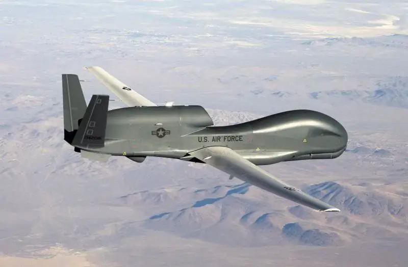
The RQ-4 Global Hawk UAV program was launched in May 1995, when the Teledyne Ryan Aeronautical (TRA) project was declared the winner in the competition for the best UAV under the Tier II + program. The competition lasted 6 months, five firms - applicants took part in it.
The new drone, among other things, was considered as a replacement for the Lockheed U-2 long-range high-altitude reconnaissance aircraft, which had been in operation since 1956.
Teledyne Ryan already had experience in drone design. The long-range high-altitude reconnaissance AQM-34 Firebee created by this company worked well in Vietnam, several hundred of these drones were built.
In 1999, the firm was taken over by Northrop Grumman and became a division of the firm.
RQ-4 is made according to the normal aerodynamic design with a low wing high aspect ratio. The wing, manufactured by the Boeing concern, is completely made of composite material based on carbon fiber.
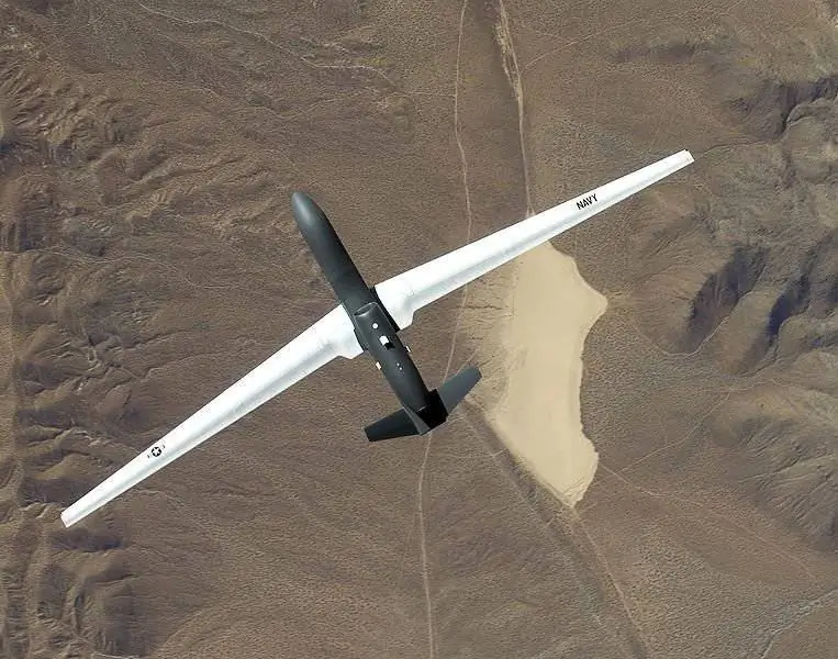
This made it possible to create a thin, lightweight and durable wing of high aspect ratio. There are at least two external suspension points on the wing, designed for a load weighing up to 450 kg each. Three-point chassis with nose wheel. There is one wheel on the nose landing gear, and two wheels on the underwing struts. The semi-monocoque fuselage is manufactured by Teledyne Ryan from aluminum alloys. It has three main parts. The instrument compartment is located in front. There, under a large radio-transparent fairing, a parabolic satellite antenna with a diameter of 1.22 meters is located. All reconnaissance equipment is located in the same compartment. The middle section houses a large fuel tank and the tail section houses the Allison AE 3007H turbofan jet engine. The engine is borrowed, almost unchanged, from the Citation-X and EMB-145 business jets. After making small changes to the control system, the engine runs stably at altitudes up to 21,300 meters.
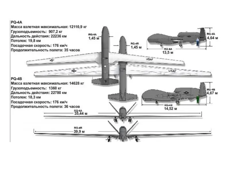
The V-shaped tail unit, manufactured by Aurora Flight Sciences, is also made of composite materials. The wingspan is approximately 35 meters, the length is 13.3 meters, and the take-off weight is approaching 15 tons. The device can patrol for 30 hours at an altitude of 18,000 meters.
According to experts from the Northrop Grumman development company, Global Hawk can cover the distance from the Sigonella VVB to Johannesburg and back at one filling station.
The Global Hawk first flew on February 28, 1998, from Edwards Air Force Base.
In the first flight, an altitude of 9750 meters was reached, at a speed of 280 km / h. Thanks to the use of the GPS differential navigation system, the deviation from the runway axis after landing was less than 0.5 meters.
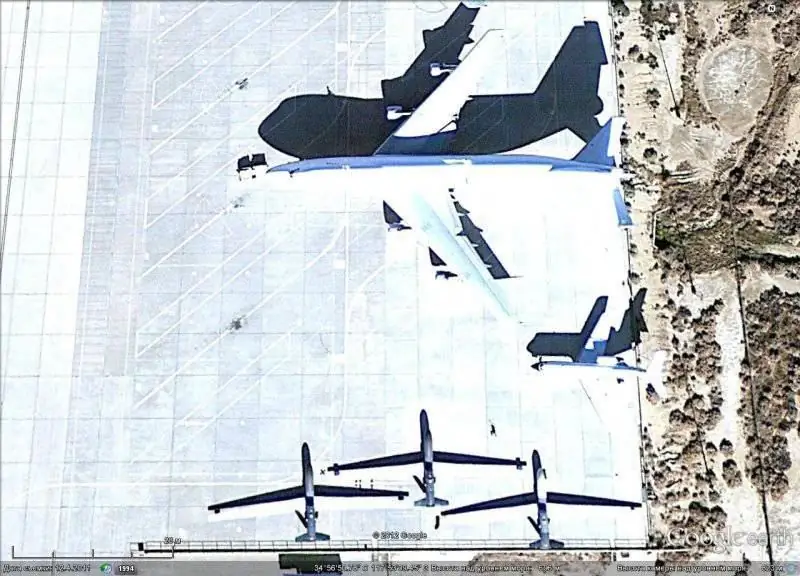
Satellite image of Google Earth: Global Hawk at Edwards AFB
The first 7 built vehicles were created as part of the Advanced Technology Demonstration (ACTD) program, and were intended to assess the ability to perform special tasks. The world situation provided a high demand for this UAV, and the first prototypes were immediately sent to Afghanistan.
The RQ-4 Global Hawk was produced in parallel with ongoing development. Nine Block 10 UAVs (sometimes called the RQ-4A model) were manufactured, two of which were immediately acquired by the United States Navy. Three devices were sent to Iraq. The last UAVs of the first serial modification Block 10 were received on June 26, 2006.
Further, within the framework of the RQ-4B model, there appeared:
Block 20 - it has increased payload and wingspan (up to 39.8 m), and its flight range has been reduced to 8,700 nautical miles.
Block 30 is a revised version, officially adopted by the US Air Force in August 2011.
Block 40 - which made its first flight on November 16, 2009. The main difference from previous Block 20/30 modifications is the MP-RTIP multi-platform radar.
The cost of one machine is about $ 35 million (together with the development, the cost reaches $ 123.2 million). To date, about 40 drones of all modifications have been assembled.
The UAV is used as a platform for various reconnaissance equipment. The Global Hawk is equipped with three reconnaissance equipment subsystems. They operate at different wavelengths and can work simultaneously.
The synthetic aperture radar is manufactured by Raytheon and is designed to operate in all weather conditions. In normal mode, it provides a radar image of the terrain with a resolution of 1 meter. In a day, an image can be obtained from an area of 138, 000 km2 at a distance of 200 km. In point mode, shooting an area of 2 x 2 km, in 24 hours more than 1900 images with a resolution of 0.3 m can be obtained. Using the Doppler effect, the radar can track a moving target if its speed is more than 7 km / h.
Two radar antennas (located on the sides in the lower part of the fuselage instrument compartment, length 1.21 m). Electronic equipment weighing 290 kg consume 6 kW of electricity.
The daytime electro-optical digital camera is manufactured by Hughes and provides high resolution images. The sensor (1,024 x 1,024 pixels) is mated to a telephoto lens with a focal length of 1,750 mm. There are two modes of operation, depending on the program. The first is scanning a strip 10 km wide. The second is a detailed image of a 2 x 2 km area. An IR sensor (640 x 480 pixels) is used to obtain night images. He uses the same telephoto lens. The lens can be rotated 80 degrees.
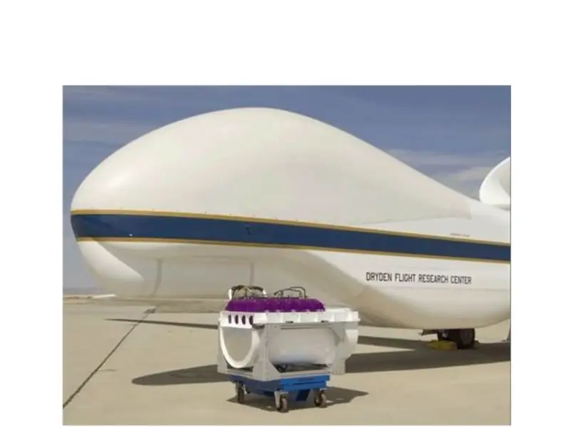
Global Hawk and its EO / IR sensor unit
Radar, daytime and infrared cameras can work at the same time, which provides a large amount of information. The combined day / night infrared camera has an information output rate of 40 million pixels per second, which is 400 Mbps depending on the color resolution. The onboard system for collecting and storing information compresses the received digital images and records them.
Several communication channels can be used to transmit information to consumers. The speed of information transmission via the satellite channel is 50 Mbit / s. For these purposes, the satellite communication system SATCOM is used, the antenna diameter is 1.22 meters. On a UHF radio channel within the line of sight, information can be transmitted at a speed of 137 Mbit / s.
The information is sent to the ground flight control station and to the take-off / landing control station. Users not connected to the ground station will be able to receive images directly from the Global Hawk UAV.
Global Hawk is integrated into existing tactical aerial reconnaissance systems (flight planning, data processing, operations and information dissemination). It is connected to systems: the Joint Intelligence Support System (JDISS) and the Global Command and Control System (GCCS). The resulting images can be transmitted to the operational commander for immediate use. The data obtained from the UAV is used for target detection, for planning strike operations for reconnaissance, as well as for solving other problems.
A UAV without the use of stealth technologies should have a sufficiently high survival rate. To ensure this, the Global Hawk is equipped with an AN / ALR 89 RWR radar exposure detector and jamming stations. If necessary, he can use the towed jammer ALE-50. Experiments on simulation of real situations have shown that the Global Hawk can, on average, make more than 200 sorties if its flight route is planned taking into account the current situation (outside of active combat zones).
The ground segment of the Global Hawk system includes a mission control unit and launch and maintenance items manufactured by Raytheon. The job control unit is used for scheduling, managing, processing and transmitting images. The launch and maintenance system provides accurate global positioning satellite positioning system differential correction for accurate takeoff and landing, while in-flight GPS with inertial navigation system is used. Due to the separation of the elements of the ground station, each part of it can be located in a different part of the world. The job control unit is often co-located with the main control point. Both elements are housed in a military container along with an internal antenna for direct communications and satellite communications equipment.
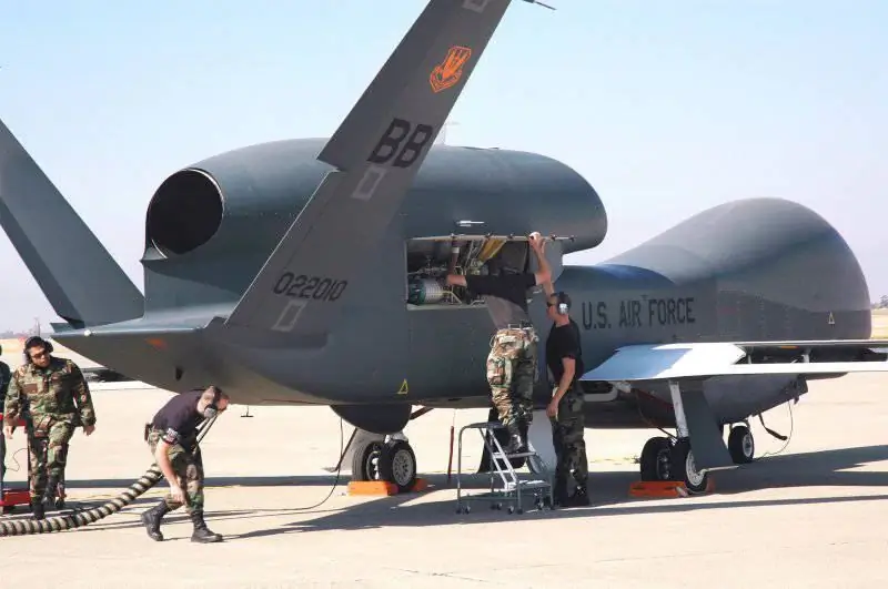
UAVs RQ-4 Global Hawk were used during military operations in Afghanistan, Iraq and Libya. Most likely they will be used during the operation against Syria.
Currently, the infrastructure is being equipped and equipment is being installed for the use of strategic high-altitude reconnaissance RQ-4 "Global Hawk" in different parts of the world.
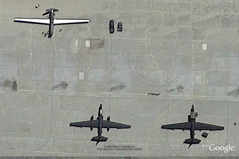
Satellite image of Google Earth: Global Hawk and U-2 reconnaissance aircraft at Baele airbase
At the first stage, the task was set for their effective use in Europe, the Middle East and North Africa. For this, it is planned to use the US Air Force base on the island of Sicily, on the territory of the Italian air force base "Sigonella".
The choice of the RQ-4 Global Hawk UAV as the main means of conducting aerial reconnaissance and surveillance, including in the zone of Europe and Africa, is by no means accidental. Today this drone with a wingspan of 39.9 m can be called without exaggeration the actual uncrowned "king of drones". The device has a takeoff weight of about 14.5 tons and carries a payload of more than 1300 kilograms. He is able to stay in the air without landing or refueling for up to 36 hours, while maintaining a speed of about 570 kilometers per hour. The ferry range of the UAV exceeds 22 thousand kilometers.
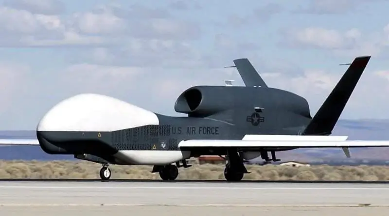
In addition to military reconnaissance missions, the RQ-4 Global Hawk is actively used for environmental monitoring for scientific purposes.
Several machines are used by NASA at the Dreiden Science Center for high-altitude research flights. The UAV was used to measure the ozone layer and the transport of pollution across the oceans.
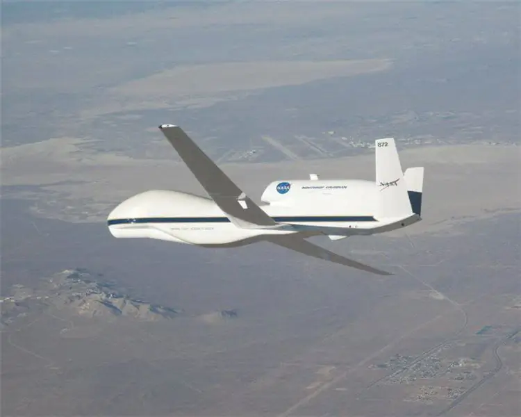
In August, September 2010, one of the spacecraft participated in NASA's Genesis and Rapid Intensification Program, as part of the research of the Atlantic basin for the occurrence of hurricanes. It was equipped with weather sensors, including a Ku-band radar, a lightning display sensor and cameras from which a parachute radiosonde is ejected.
Drones could be used to explore Antarctica when they were based and operating in Chile.
During the liquidation of the consequences of natural disasters, flights were made over the territory of the United States to assess the damage from Hurricane Ike and the California fires.
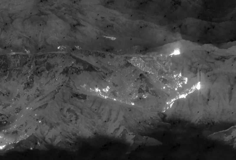
A photograph of the 2008 US Navy Global Hawk fires in Northern California.
Several US allies have expressed interest in acquiring the Global Hawk.
Germany chose the RQ-4B to replace the outdated Breguet Atlantic patrol aircraft, christening it the Euro Hawk. The vehicle retained the original airframe, but received reconnaissance equipment from EADS. The sensor kit includes 6 fender hangers.
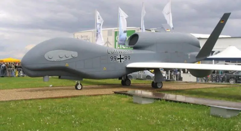
EuroHawk officially entered service on October 8, 2009 and first flew on June 29, 2010. It underwent flight tests at Edwards AFB for several months before flying in Germany in May 2011. Initially, it joined WTD61, Ingolstadt Airport Manching.
The cost of the first 5 machines was 430 million € for development and the same amount for the purchase.
Canada plans to replace the CP-140 Aurora patrol aircraft designed for maritime and ground surveillance. For work in the Arctic, in conditions of extremely low temperatures, Northrop Grumman specialists have created a modification of the Polar Hawk.
In addition, negotiations are underway for deliveries with Australia, Spain and Japan. India is also a potential buyer.


